#googleurbanism or: Remote Research

#googleurbanism or: Remote Research
#tcl_block--article-text

Can digital tools enable an exploratory access to distant territories?

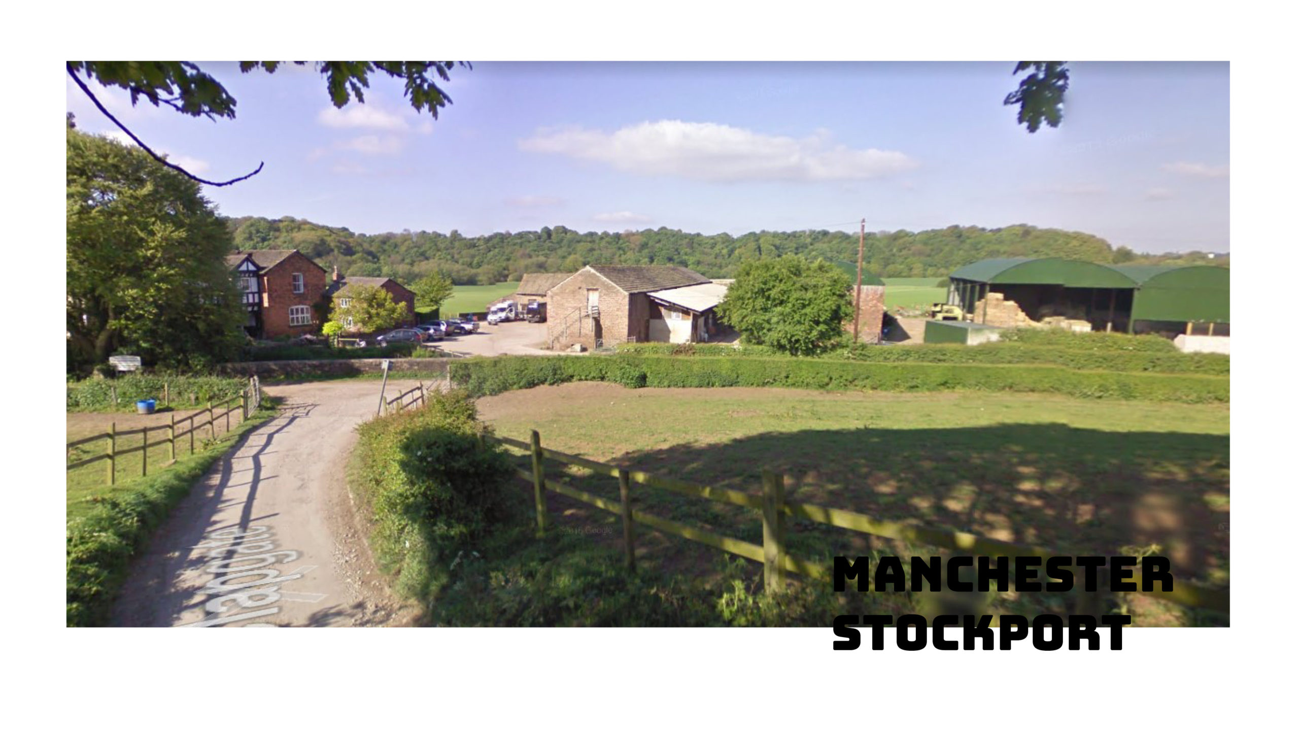
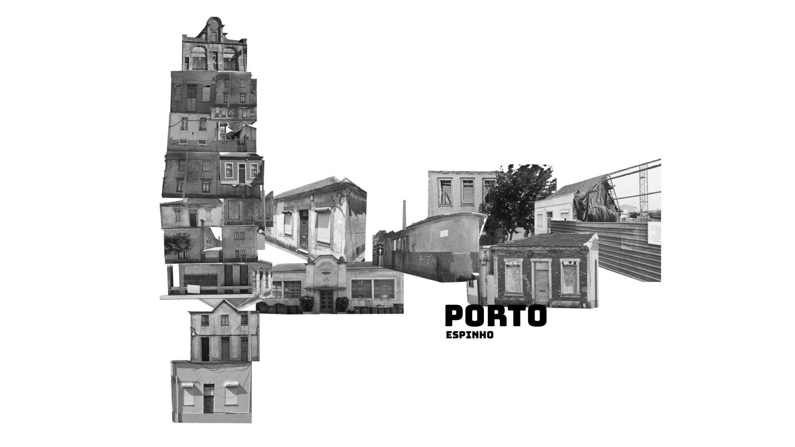
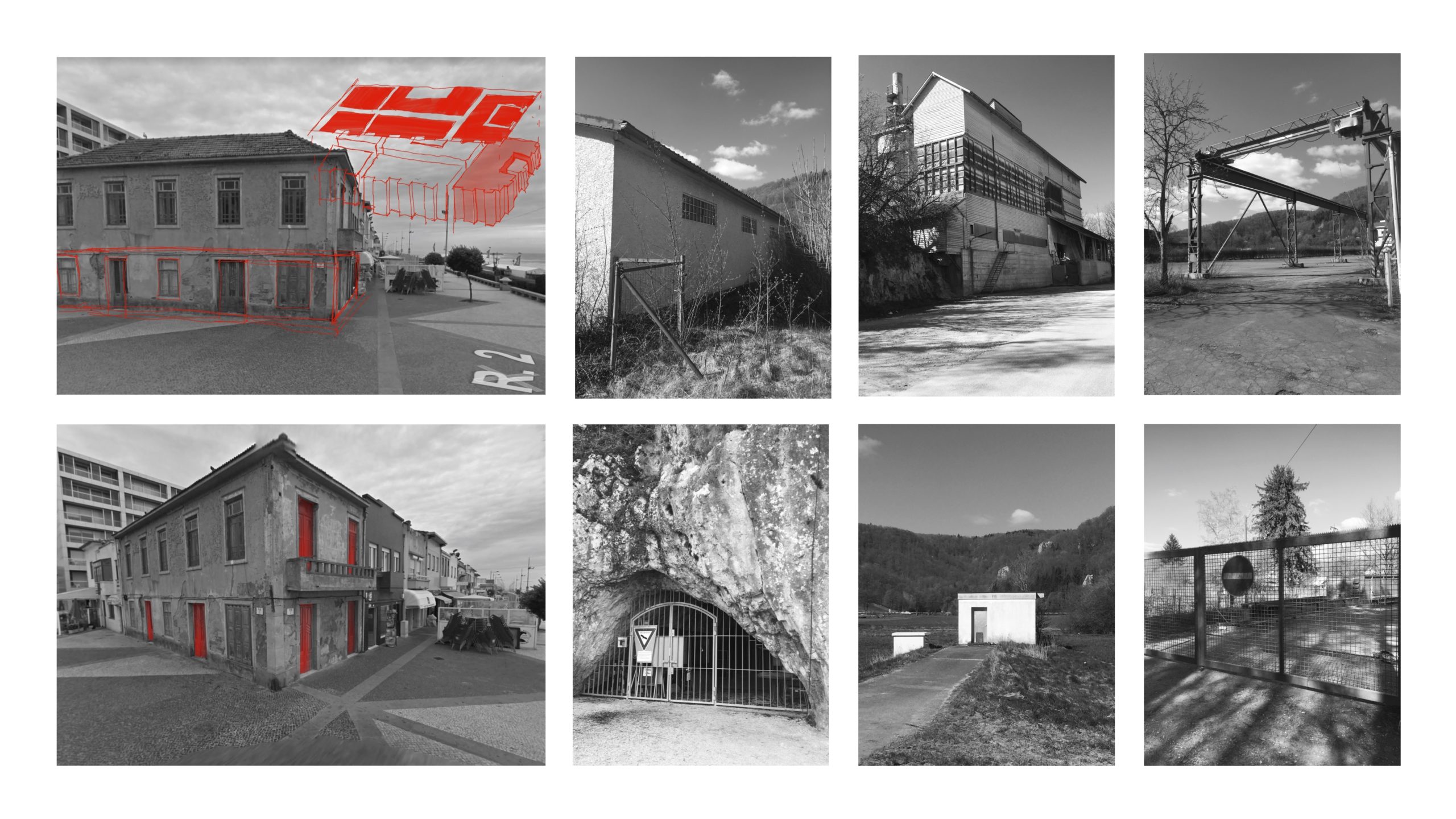
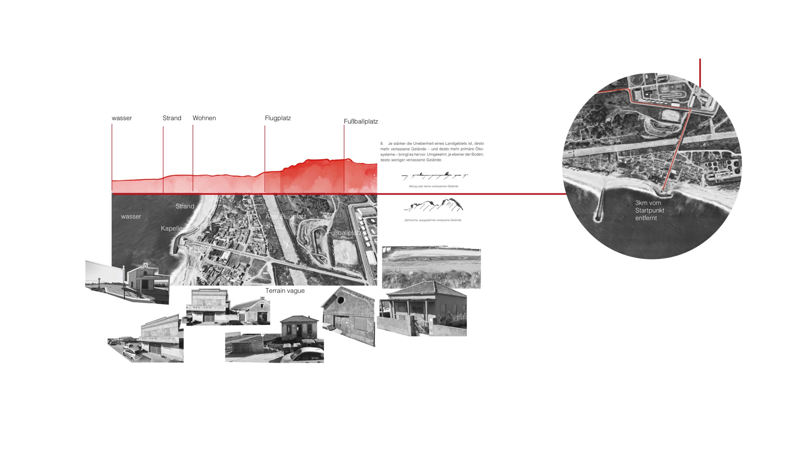
Terrain Vague – In 1995 the Catalan architect and philosopher Ignasi de Solà-Morales Rubio challenged our understanding of urban territory . His seminal article began by looking at how photography’s technical and aesthetic development had decisively influenced our memory, perception and imagination of the modern metropolis. The photographer’s gaze – selective and manipulative – had co-shaped the idea of big cities’ physical constitutions as well as people’s urban lives throughout a century, and from the 1970s on had detected the attractiveness of those urban voids and residual spaces Morales choose to name “terrain vague”. The cloud of meanings the author derived from the semiotics of the term well reflects some of the characteristics we rediscover in the 21st century’s urbanized landscapes between cities: Fluctuating and instable in use, spatially lacking precise confinements, blurred and uncertain in character, but precisely because of this oscillating condition, evocative and full of expectancy.

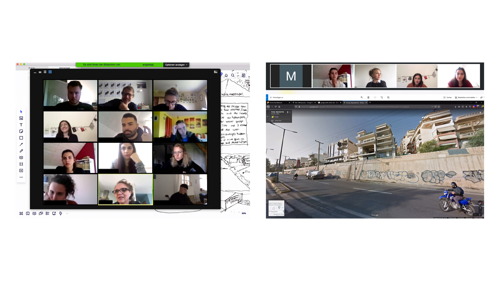
The interest for just this kind of territorial vagueness forms the core of growing research interest . Morales’ article offers a second, equally potent, but still-to-be-discovered legacy, though: It prompts us to rethink the automatic distinction we make between (seemingly) authentic real-life experience and mediated (web)representation of contemporary spatial conditions. In recent years it has become impossible to separate our notion of the (un)built world from omnipresent Google representations. In addition, we as urban researchers have been allowed virtual access to even the most distant places on earth from the comfort of our offices. This being self-evident for some years now, it has hit a new-high as the pandemic experience forced the profession to reflect and innovate their instruments and methods. Starting from where we stand, it is time to seriously allow analysis and research options that stem from open source data, social media and big-data companies or personalized online imageries to become part of an urbanist’s professional toolbox. We argue that accessing online representations can provide new processes, uncover different mechanisms and foster additional ways of understanding when applied within carefully set and strictly controlled methodical frameworks. We should extend the efforts – putting an emphasis on the critical evaluation of and reflection on all these materials to establish a credible base for our findings.

#tcl_block--article-text

“We should therefore delineate some provisional terrains of observation, including the observation of certain processes of chance and predictability in the streets”
Guy Debord (1955)

#tcl_block--article-text

Mapping the globe

Digitization has multiplied mapping options in urban research. Leading institutions have demonstrated how dominating themes of urbanisation like the urban economy, social equity, climate change and governance can be represented through mapping and information design in the most appetizing ways. Two examples: The LSE Cities Initiative funnels investment into global level overviews and the data-based construction of visualisations on a city level. Comparatively (competitively) mapping what they call the “urban age” is a core-tool to push major cities to deliver contributions to large-scale change. Part of Harvard’s GSD Urban Theory labs’ academic work takes the opposite position, framing urbanization processes in the global hinterland and countryside as a more pressing issue. Nevertheless, the lab equally relies on high-end graphic representation, building their arguments around mappings drawn from a variety of online and professional sources. In transdisciplinary research on wider urban areas, productive landscapes and dispersed territorial patterns, the need to rely on creative cartography is even more essential to make a point : Only the intentional and/or experimental overlay of functional, infrastructural and geopolitical data displays robust evidence for novel territorial readings.

Our first remote research experiment Framing the Edges set out to extract urban-landscape profiles from open-source data in selected regions across Europe. Mapping parameter-like land-use and infrastructure at metropolitan fringes or in-between belts (i.e. Milton Keynes to Cambridge, Ventspils to Riga, Nizza to Marseilles and Venice to Trieste), we soon started to find counter-evidence to the assumption that productivity in Europe would most vitally buzz close to powerful urban nodes. Scientifically, these early maps can only stimulate a sounder type of research. On the other hand, maps are statements. Cartography always composes analytic (intentionally objective) and narrative (necessarily subjective) information. The author of the map selects the relevant parameter he/she wants to include in the representation according to an exclusive and interpretational agenda – and any systematic superposition of fact-based layers is as deliberate a choice as an experiment-driven detecting palimpsest. The exponentially growing availability of open-source material simply amplifies possible combinations. We can critically work with this new source, ask unthought-of questions in analysis processes or sometimes produce the crucial early finding that legitimates further inquiry.

In the process, we experienced data availability and -scale as both a limit and a potential: comparable open-source and official data are easily available using European datahubs and automatic sampling. Still, when we turned our attention to an individual object, the exact demarcation of land-uses and fine-grain topographic or functional situations, trust in their accuracy erodes. The resolution is too poor for a true understanding of facts and additional sources (i.e. local expertise, photography and a literature review) have to complement and verify initial structural findings. You still have put your boots on the ground.

#tcl_block--article-gallery
Productive landscapes made from built and unbuilt elements form continuous urbanized corridors aligned with infrastructures along the Mediterranean coastline of France. Source: urbanes.land / Julia Bauer
#tcl_block--article-text

Picturing the world from a distance

When it comes to visual representation, photos or videos, our opinion of what is (un)real is considerably more delicate. Google aerials are largely tolerated when supporting an argument – Street View shots account as substitutional device at best. But, editing online material has become an artistic and urban avantgarde practice. Handled methodically, this also can inspire the use of additional tools in urban research. The Agoraphobic Traveller is an online-based photographic practice by Jacqui Kenny, where the author presents Street View “travel” portraits of remote areas all over the globe. Kenny works with traditional means – framing, composition, detail – in what she calls the “strange and expansive parallel universe of Street View”. As an artist, she finds nothing virtual in the careful representation of far-away towns and landscapes, everyday architecture and anonymous people – all captured in real time in their real lives.

In Framing the Edges, Google photography became crucial for zooming into the reality of the distant territories under investigation. Reflecting structural insights or intuitive assumptions against this “material” world helped to sharpen our gaze and suggest physical portraits. Like Kenny, the students would cast a photographer’s eye on the far-away spaces, trying to extract “real” impressions and work with the apparent vagueness. Interestingly, this online-photography shares a lot with the analogue process: Sometimes an accidental snapshot would capture the essence of an object or space – more often than not, it would take careful editing, though, framing, cutting or omitting, contextualizing or de-contextualizing the material to deliver an adequate report.

#tcl_block--article-gallery
Results from Google Street View exploring territorial characteristics in the remote research studio International Urbanism Sources: All images from Google Street View, credit: urbanes.land / remote research studios‘ participants
#tcl_block--article-text

Admittedly, time-laggings or gaps are an issue. Whoever necessitates great accuracy regarding a specific place at a precise moment in time should resist extracting evidence from online journeys. Driving under a bridge in Street View mode can exhibit a colourful graffito on the bridge’s posts when travelling in one – a simple concrete surface when travelling in the other direction. The same in-coherence of time and space can also deliver unusual findings, though. Traces, marks and leftovers i.e. from festivals or other temporary events can be found in a (seemingly) mono-structural agrarian landscape, secretly coding the territory with indications of urban densities and habitus.

Assembling realities from informational ambiguities, gaps and montages

Judith Schalansky’s Atlas of Remote Islands (Fifty islands I have never set foot on and never will) is another inspiring gateway to a distant research practice. The book is fifty percent written – fifty percent cartographic, a fact-based product of geographical, demographic and historical studies augmented with anecdotal fragments. The author presents her cases with unconditional care, leaving no room for doubt in the seriousness of her report but lots of space for inspiration and self-determined time and space-travel.

Similarly, our second remote research practice Terrain Vague was intended to familiarize people with local conditions and unfold specific realities to an extent that would ultimately enable and justify proposals for intervention. Participants roamed the streets of unheard-of places like La Penne-sur-Huveaune/FR, Espinho/POR or Bolderāja/LT, Perama/GR or Willebroek/NL. They collected background material and strolled online alleys. They lingered on corners, stairs or in parks, produced diaries, sketches, drawings and videos and started to discover situational meanings. It took them just as long as in any “real” survey to find what aspirations a seemingly banal space of the everyday – many of them mentally exterior in the physical interior of a city – could possibly hold. Sometimes, representational access of the web-survey would help to blur the difference between distinct and generic, unveiling truly urban conditions in apparently suburban towns. But, like in any academic experiment, students would fail to produce consistent results, when they didn’t establish a strong-enough method to control their remote dives or were reluctant to push the tools’ limits. After weeks of travelling, everyone cast a speculative eye on a site they had never been to but started to know just as well as their home, where by then an international lockdown had frozen them into.

#tcl_block--article-text

#tcl_block--video
A suburban hike resulted in a montage of moving and still images, speculating on the character of spatial thresholds in the peri-urban landscape of La Penne-sur-Huveaune. Sources: All images and sequences from Google Street View, credit: urbanes.land / raumlabor / remote research studios‘ participants
#tcl_block--article-text

Ironically, it was the lockdown’s radical obstruction that inspired an additional method, which would somewhat unburden the experiment from a fundamental critique. Research that is solely net-based necessarily disregards data-security, equity issues of their availability or semi-hidden to fully transparent interests of the providers: Google i.e. only processing a tightly tailored part of the globe – while motivations of other sources simply remain harder to decode. The attempt to reality-check our projects without being able to travel, built on another artist’s practice. In her project A friend is a friend of a friend, photographer Birgit Glatzel followed acquaintances and their networks of friends on a four year foray around the globe . While portraying different people, she always let herself be forwarded to the next friend, contact or willing partner in the experiment. Translating the method into planning practice meant establishing an introductory contact in each location – a possible start for a chain of people who could become our eyes and ears. Talking to strangers on the phone or directing Instagram fellows to a particular site, asking them to take photographs and share their perspectives became a way to include local testimony and influence. It helped questioning and enriching the proposals in the final stage of the project and counteracted some of the digital biases.

#tcl_block--article-gallery
Working with vacancies and mental gaps in northern Portugal’s coastal sprawl, one proposal projected the cast of residual built space onto a natural pier. Local testimony acknowledged conflicting land use and the relevance of collective memories. Sources: All images and sequences from Google Street View, credit: urbanes.land / raumlabor / remote research studios‘ participants.
#tcl_block--article-text

Remote research: A valid form of analysis?

Online, we have remote access to the world. Information blends. Available sources can overlap in time, double information or leave gaps. We can sneak into other people’s everyday realities or discover unknown vague territories on our own means – strolling the Google streets, sneaking around in local blogs, talking to friends and strangers online or floating in globe-mode at 100ft, getting a glimpse of sites hidden to the eye of physical presence. Pretending to be there, we can apply every single practice learned from Guy Debord and his pals: Execute unplanned drifts led by random encounters and personal preference, impartially study foreign or familiar places, rerouting to taste. In addition, we can build on tech gadgets, multiple media and personal networks. This general disposition notwithstanding, it needs a lot more and multiple approaches to remote research options to explore their transgressive potential and suitability to cast an independent look. Online reality is frozen in time, its availability agenda driven. It is a 21st century flaneur experience, a way to wander before wandering. We certainly need to direct the use of it to fields where insights and questions can be generated exactly from these somewhat speculative, blurred or contradictory bases. And, any examination has to involve clear methodical frameworks, careful curating of the process and responsible compiling of the various findings. Nevertheless, Morales and others publishing in Anyone Corporation’s think tank at the time were driven by the apparent need to deconstruct a conservatively homogeneous representation of architecture and the city. It would be similarly urgent now, in order to give space to multiple urban realities inside and outside cities that dissent the marketable omnipresence of branded urban lifestyles. The fact that this presence stems and multiplies from media manipulation might give urban researchers good reason to undercut this production by its own means.

#tcl_block--article-gallery
Wandering before wandering, questioning the aptitude of online tools to cast an independent look and socialize through distance in online classes. Sources: Screen-shots from remote research studios, credit: urbanes.land / raumlabor / remote research studios‘ participants.
#tcl_block--article-additional-info

Christof Mayer studied architecture in Berlin and London. He is one of the founders of the group raumlaborberlin. Christof Mayer has taught in Germany, Australia and Switzerland, and since 2017 he has been professor APP/DAV at the Bergen School of Architecture in Norway.

#tcl_block--article-additional-info

Ute Meyer is the founder of the urbanes.land initiative. She is a professor for urbanism and design, Dean of the Faculty of Architecture and Energy-Engineering at Biberach University and a LSECities fellow. She is convinced that evidence-based analysis, political dialogue and critical participation are the three key elements for shaping an innovative planning practice outside urban cores.

#tcl_block--article-additional-info

All visuals retrieved from urbanes.land / raumlabor: Experimental remote research labs. University of applied Sciences Biberach, DE. Participants: Solana Maria Amado, Julia Bauer, Niusha Blookbashi, Adrian Buck, Lilli Burkart, Ismail Caliskan, Laura Horn, Victor Hoyos, Tugba Kilic, Simon Meindl, Amira Nabulsi, Niko König, Kübra Mercan, Ann-Cathrin Müller, Salahuddin Rawashdeh, Sonja Reil, Charlotte Schick, Pasquale Steidle, Jacob Struble, Tatiana Villarroel Westerbarkey, Yiling Wang, Melina Weinmann, Anita Weißenberger, Jessica Wolf, Julia Wuchenauer, Atiye Yapici.

Video-collage and pictures by urbanes.land and Studio participants. For academic purpose only. All image sources are listed. Mainly material from Google Earth and Google Street View in fair use.

#tcl_block--article-additional-info

We are interested in your viewpoints: Comment and discuss this article on our facebook page, or get in touch with the authors or the editors by e-mailing us magazine@urbanes.land.