An adventure that is both monotonous and exhilarating

An adventure that is both monotonous and exhilarating
#tcl_block--article-text

Eric Tabuchi and Nelli Monnier dedicated ten years of their life to documenting and describing what they define as territories of France. Since 2017 they travelled across the countryside to explore singularities and commonalities of contemporary landscapes. Their photographic ventures are methodical, yet subjective, and picture the collected objects in always intriguing, sometimes incidental ways. They provide an aesthetic collection and a good reason to talk. Their findings cumulate in an online archive and serve as basis for exhibitions and material for publications to come. We talked to Eric about the project, the methods applied and his empirical views on the character of rural landscapes in this hyper-centralized European country.

Interview: Martin Spalek

#tcl_block--article-gallery
La-Beaule, Pays-guerandais
#tcl_block--article-text

Eric, your popular Instagram profile shows parts of your collection of the “Atlas des Regions Naturelles” – a photographic archive of buildings and landscapes that make up the territories of France as you define them. Can you elaborate a bit on the project: What do you portray? When did you start to do this and how do you define completion?

Eric Tabuchi: The Atlas of Natural Regions is a photography project that started in 2017. The ambition was to document, in 50 images each, the 500 natural regions also called “countries” of France or something we decide to describe as “territories”. Once achieved, at the earliest in 2024, this archive will contain 25,000 images that will constitute both geographical and architectural dimensions of these “territories”. The “natural region” designation is equivocal. Indeed, this term refers to many small territories such as la Beauce, le Cotentin, le Béarn ou les Cévennes, yet has nothing to do with the fact that they are natural in the sense of a preserved nature. Actually, these small territorial entities (which are not to be mistaken for the big regions such as Normandy, Alsace or Burgundy), with blurry frontiers, recall the pre-revolutionary French History. They predate the current division into “départements” and have no administrative value. Though it is impossible to trace their exact borders, the geological, topographical, historical and cultural limits from which they originate persist within a sort of oral tradition, as outlines of a geography that remains very vivid. It is, in that sense, in opposition to administrative regions that the expression “natural region” should be understood.

#tcl_block--article-gallery
Vexin-normand, Bouafles
Autunois, Montchanin
Cévennes, Les-Bondons
Guerigny, Nivernais
#tcl_block--article-text

Why did you choose the natural regions of France as structuring element for your work?

Eric Tabuchi: We have chosen the natural regions because of their small dimensions that allow a very precise exploration. Somehow, if we picture France as a village, and imagine that each department is a house, the natural regions would be the rooms. This is the scale we have chosen. But as opposed to a house’s room which has fixed and precise limits, the borders of the natural regions are often undefined and work in gradients: As in the colour spectrum, where we go from green to blue without interruption. In the same way, in the natural regions not delimited by a river, a ridge, a coast or any geological feature, we move progressively from a clay hill, to a forest, to limestone valleys to end up on the littoral. All these modifications are sometimes clear and distinguished while others are smoother. We chose the natural regions after many experiments as they concealed the preciseness of the scale (the resolution) while maintaining the idea that the territory is also a continuum that sometimes changes without being noticed. One last aspect defining this choice is the capacity of identification that these small territories offer. After spending some time exploring, a familiar relationship evolves and the entities are personified so well that they each become like a member of a very big family with whom we have more or less in common but still manage to get together.

#tcl_block--article-gallery
Michel Chef, Chef Pays de Retz
#tcl_block--article-text

Scrolling through the Atlas, I find so many peculiarities of architecture and rural-urban scenes. On the other hand, within some pictures you display more common characteristics. How would you characterize the settings you are portraying?

Eric Tabuchi: The Atlas is, sort of, an inventory of the objects that constitute our environments, a big catalogue of the places that can be found there, without omission. Subsequently, provided it is an archetype or an exception, everything has its place in the catalogue. A movie theatre from the thirties in a small town of the Est as much as a volcanic stone farm of the Livradois, a hydro-electric facility as much as a grocery store of a Nivernais village, a building from the suburbs or a beach house in Normandy, all of these will be on the website to present both specificities of each territory and what is common to the whole country. A menhir in the Leon in Brittany is specific to that region, a Super U gas station is common to the entire country. It’s the juxtaposition of these two objects, among many others, that will document that place. By scrolling through the megalith or the gas station section of the website, it will be possible to see what these different objects resemble and where. Thus the Atlas works according to two classification principles: one geographical, by describing a territory, the other thematic (a period of time, a typology of construction, a specific material, etc… ), which describes a type of object.

#tcl_block--article-gallery
Alpes mancelles, Pre-en-pail
Amiénois, Doullens
#tcl_block--article-text

You mentioned that you travel extensively around France. Aside from the visual layer that we can revisit in the Atlas: Do you have certain non-visual findings or experiences that you can share from your travels?

Eric Tabuchi: The making of the Atlas, due to its dimensions (25,000 photographs) and its duration (10 years), is omnipresent in our lives. Almost inextricably, this project combines work and travel.It transforms our daily lives into a kind of adventure that is both monotonous and exhilarating, into a routine and endless unexpected moments. All of this means that we eventually don’t have as much time as we would like to in order to meet people or to let ourselves drift aimlessly. Yet, even if it is not actually methodical, in parallel to the photographic work we write, film or draw and sketch. These documents, which are like a travel diary, constitute the subject matter of the exhibitions that we are doing and will be gradually integrated into the website, the design of which we are currently completing.

#tcl_block--article-gallery
Bassigny, Liffol le Petit
#tcl_block--article-text

What does representation mean to you? How do you choose what to add to the Atlas – guessing you see and shoot way more than what you present?

Eric Tabuchi: The question of representation is infinitely complex. To simplify, let’s start by considering that France was often represented by a limited number of places and subjects, at the expense of a large part of the country. Together with my partner Nelly Monnier, we thought we had to come up with a way to represent more evenly a country the diversity of which we are familiar with from our travels. In this context, representation was therefore not a matter of choosing a place or a subject but rather all the places and all the subjects related to the architecture and the landscape. In this sense our definition of representation is quite concise as it aims to describe, locate and classify the visible elements that make up our environment and to make the archive (easily) accessible.

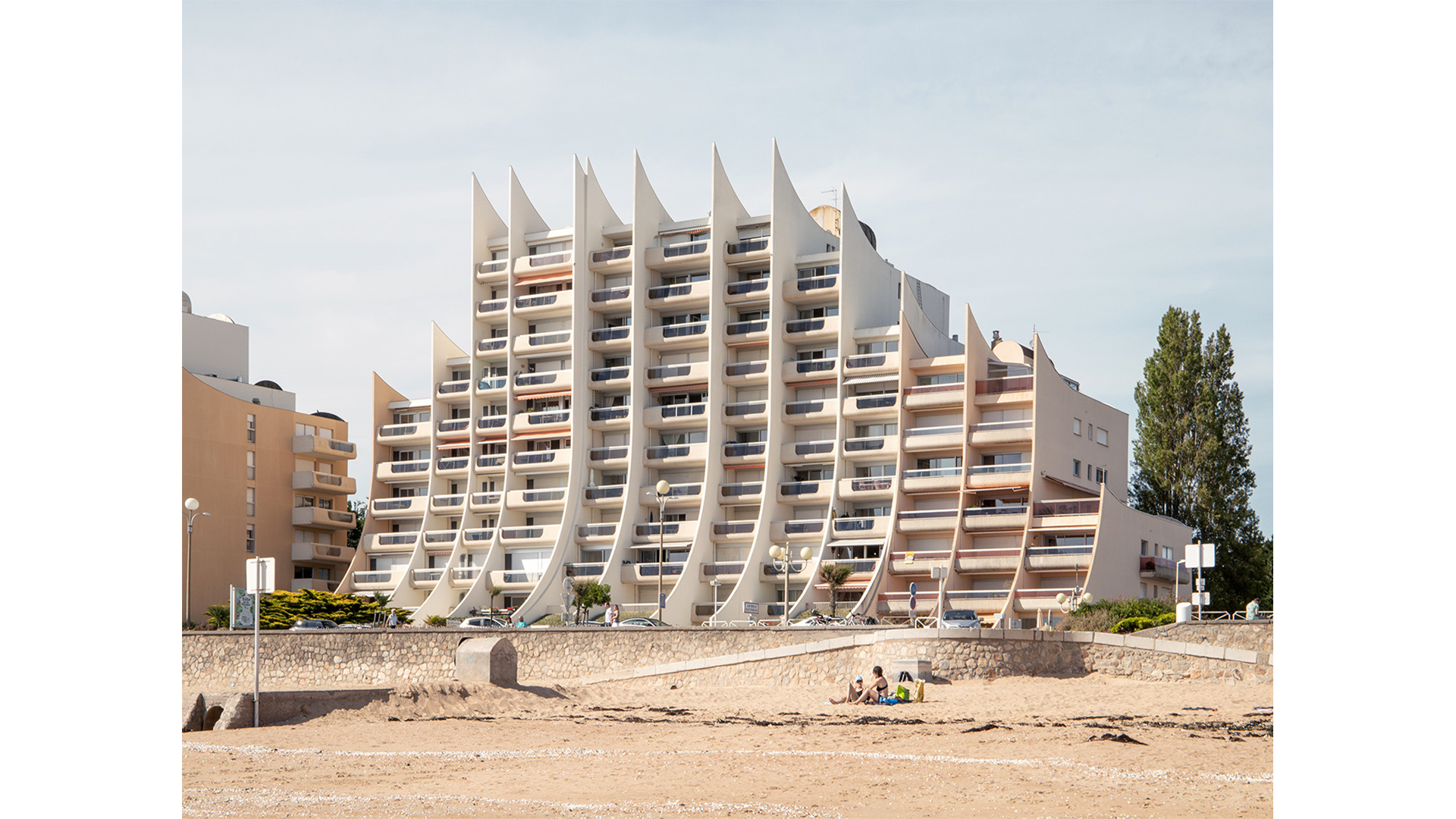
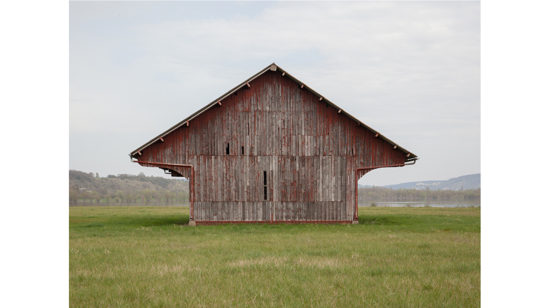
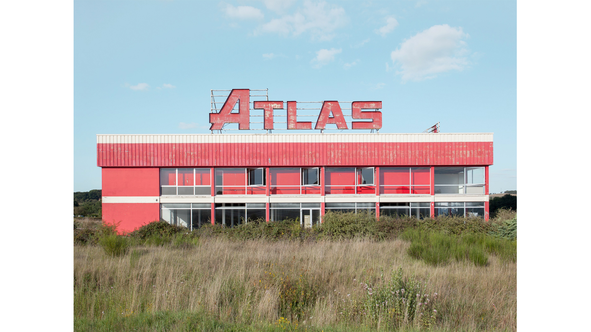
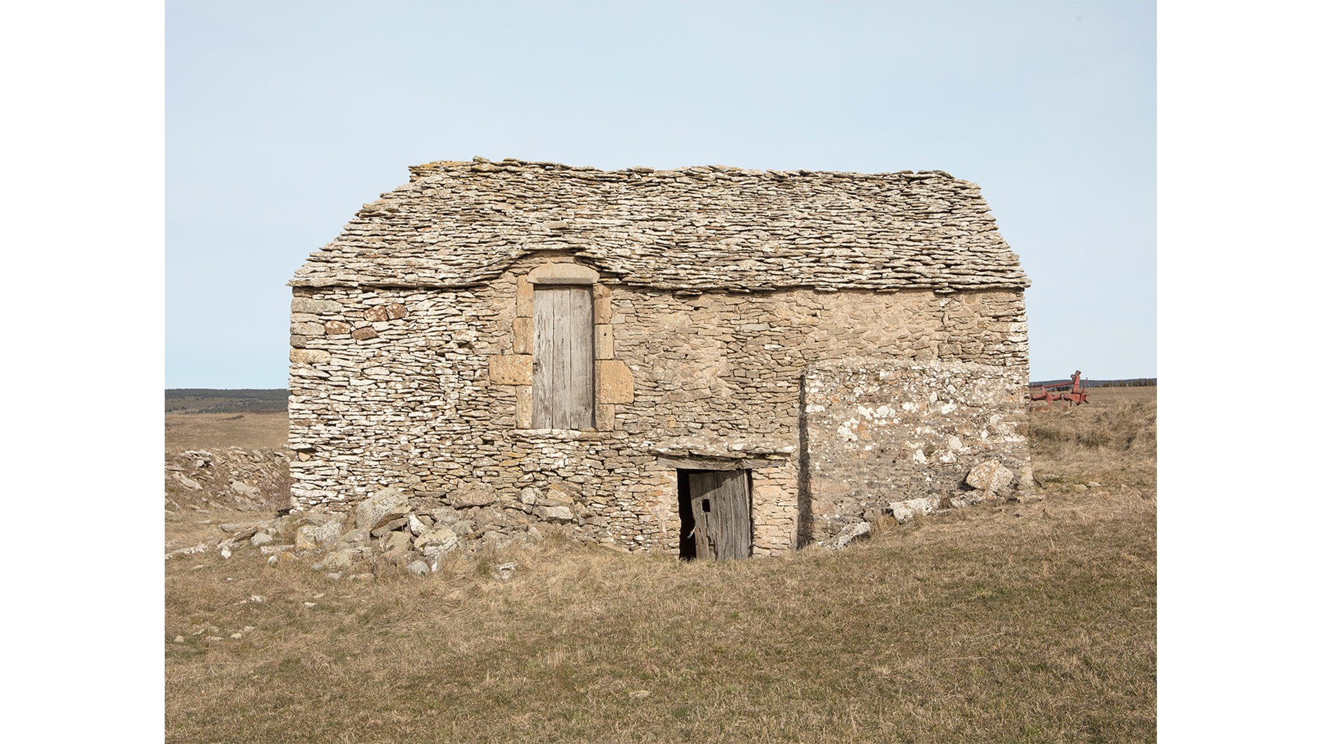
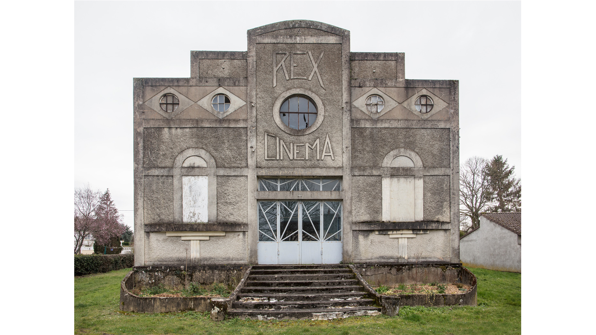
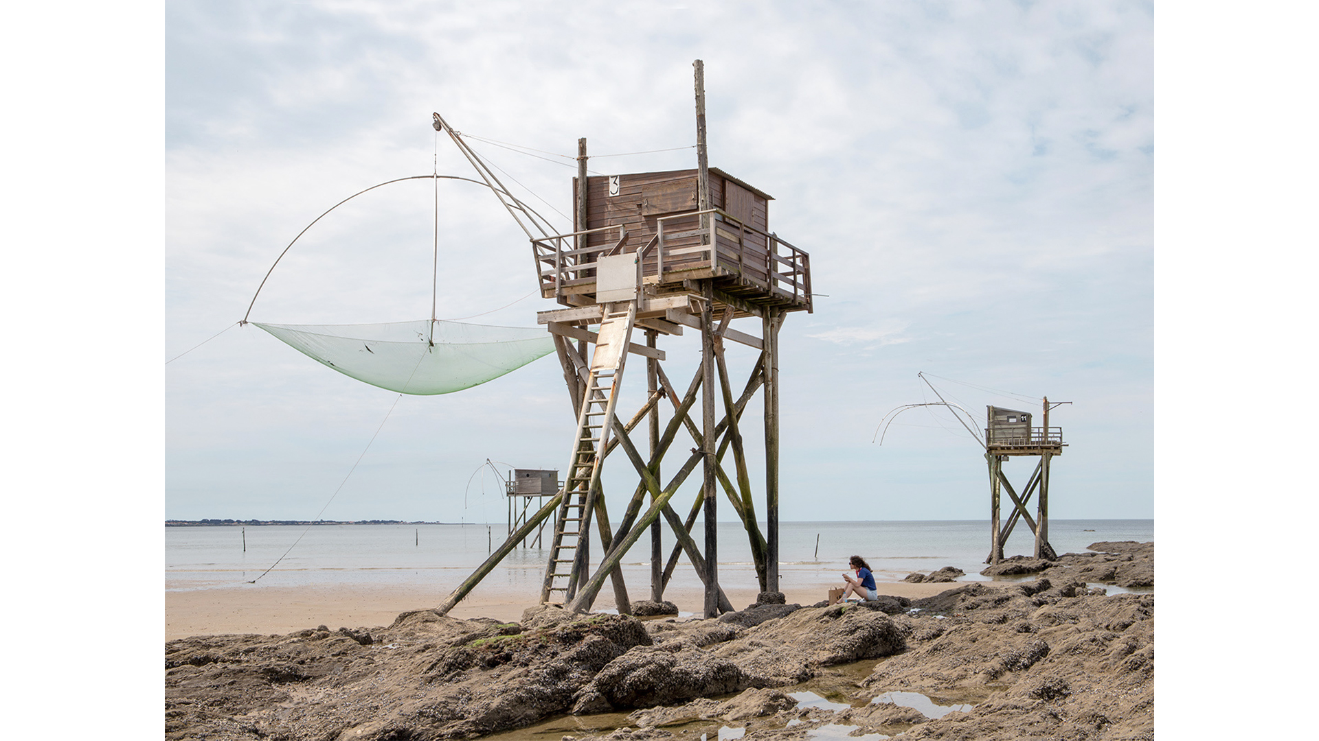
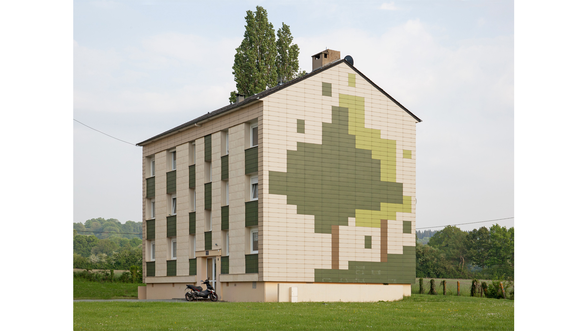
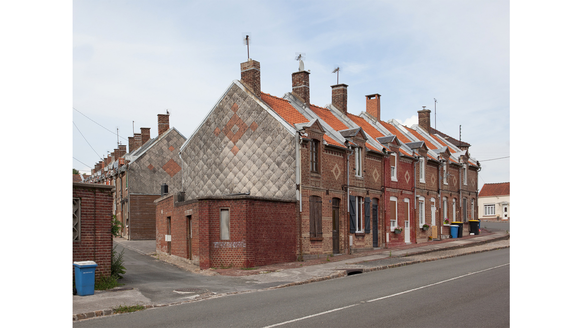
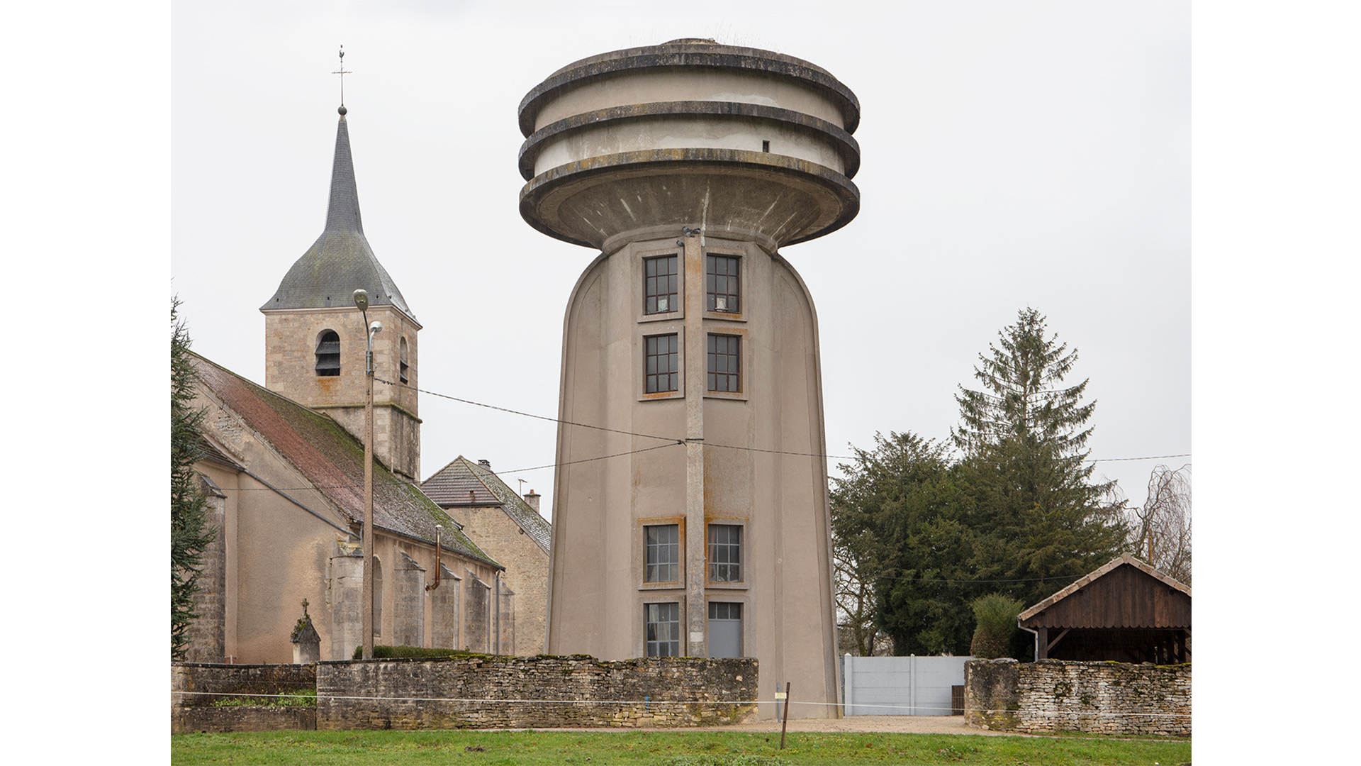
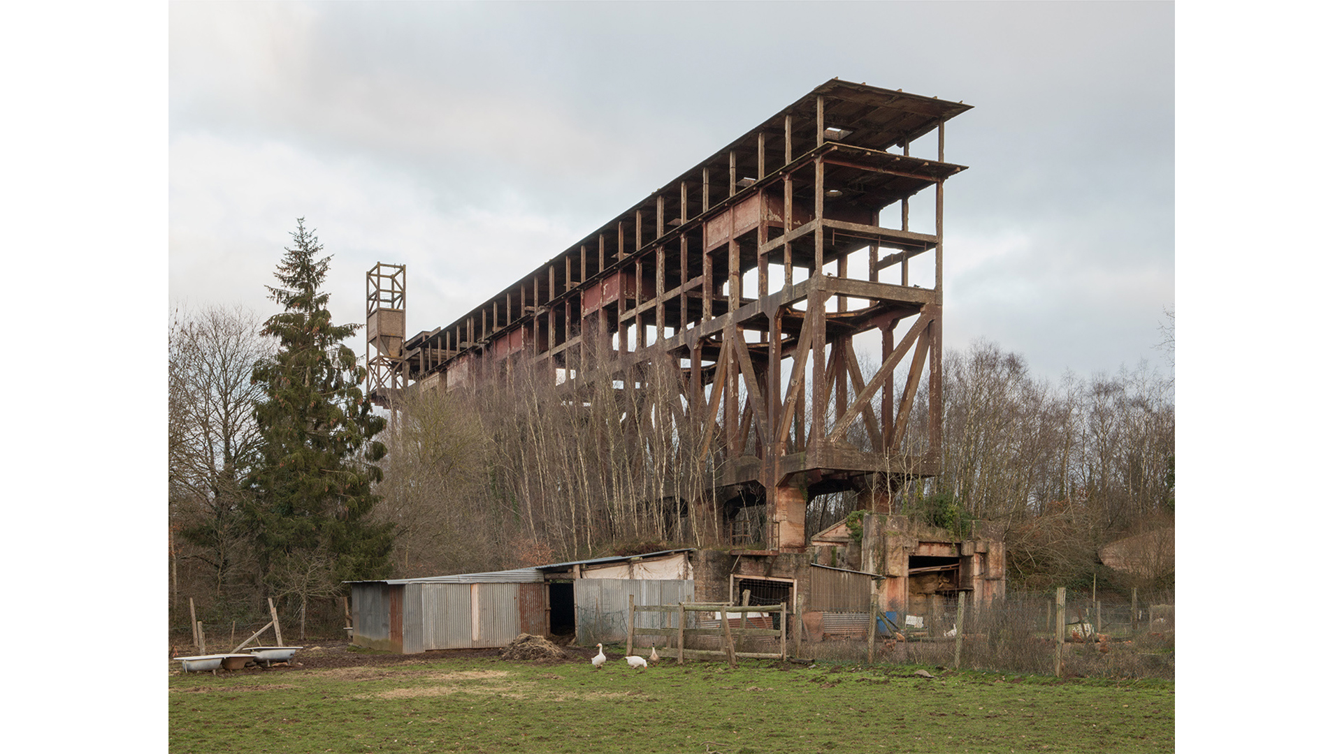
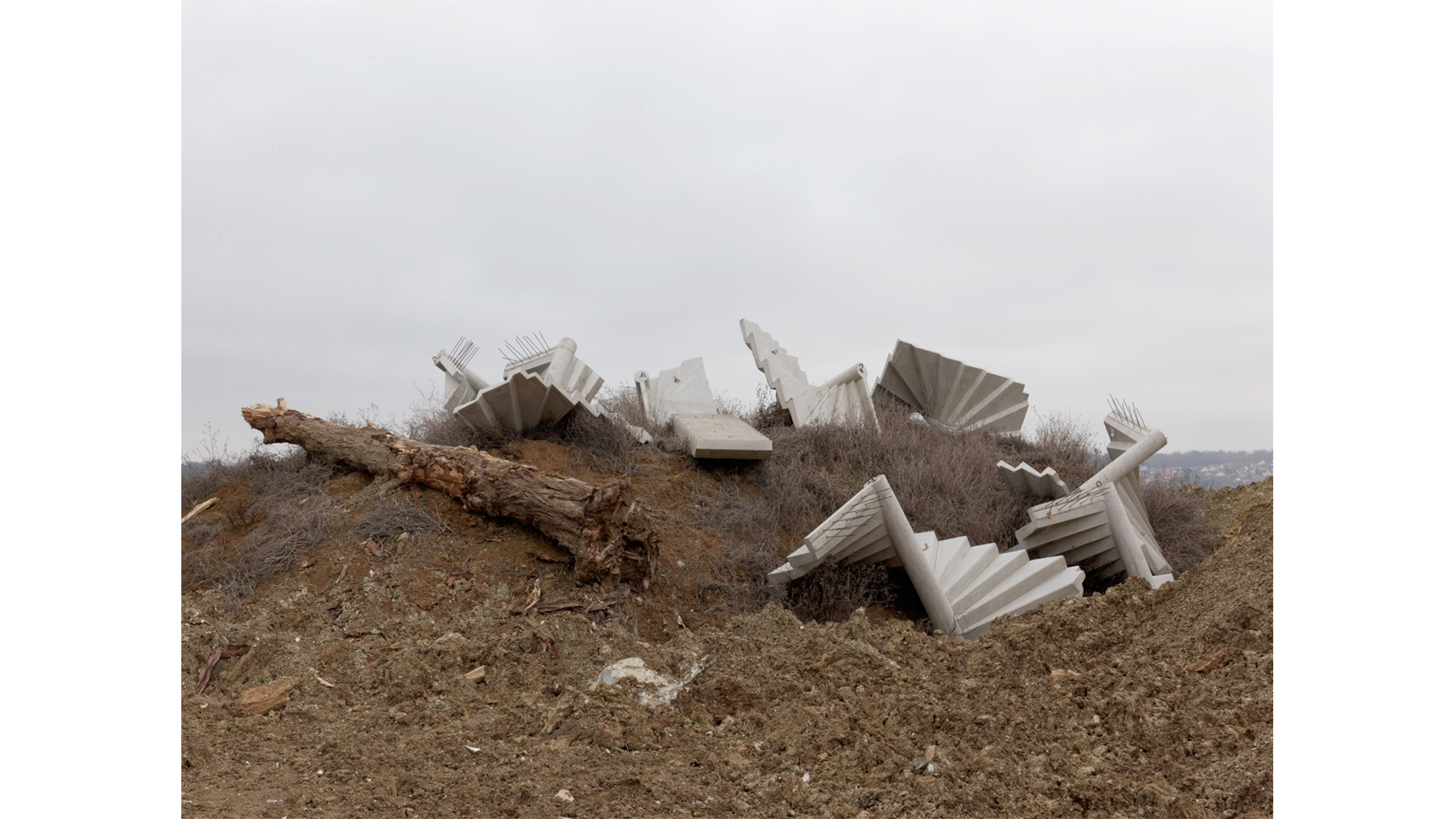
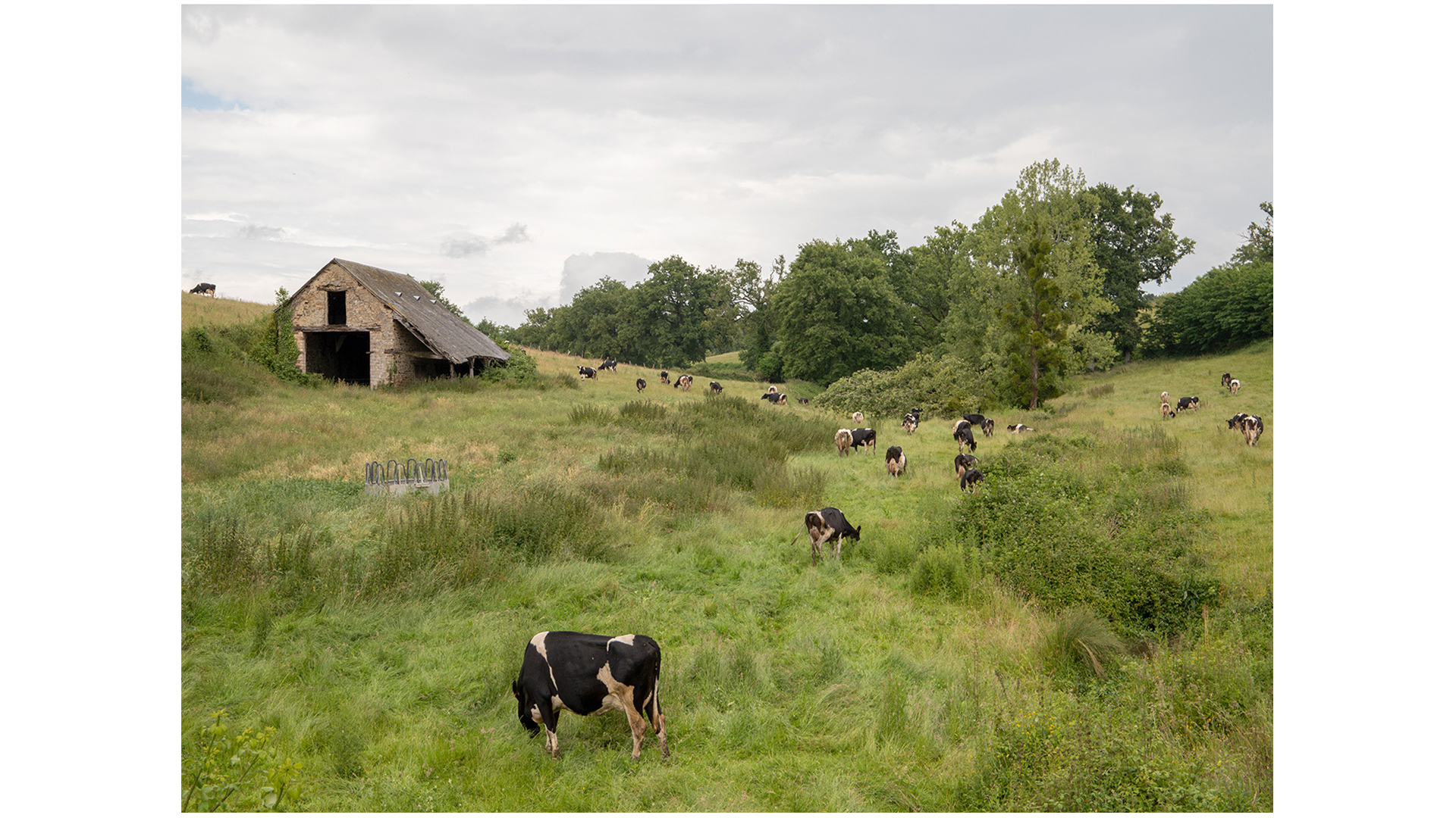
Consequently, everything that constitutes the landscape is intended to be a part of the Atlas. Whether it is a farm or a garage, a river or a mountain, a castle or a house, a stadium or a nightclub, all of the elements from the moment they are perceived are representative of their category or unique. Nothing is initially excluded from our work, provided that (and this is very limiting) the subject is easily readable, that is to say,isolated as much as possible and that it can be captured in its entirety within the photograph. Considering these criteria, there are very few possibilities left, and it is within that range that we choose a house, a farm or a building over another, according to the very subjective criteria of the appeal it has to our eyes.


You aspire to “lay the foundations for a system of representation for digital archiving applicable to any other country”. Can you give us some insight on the system and the methodology you employ?

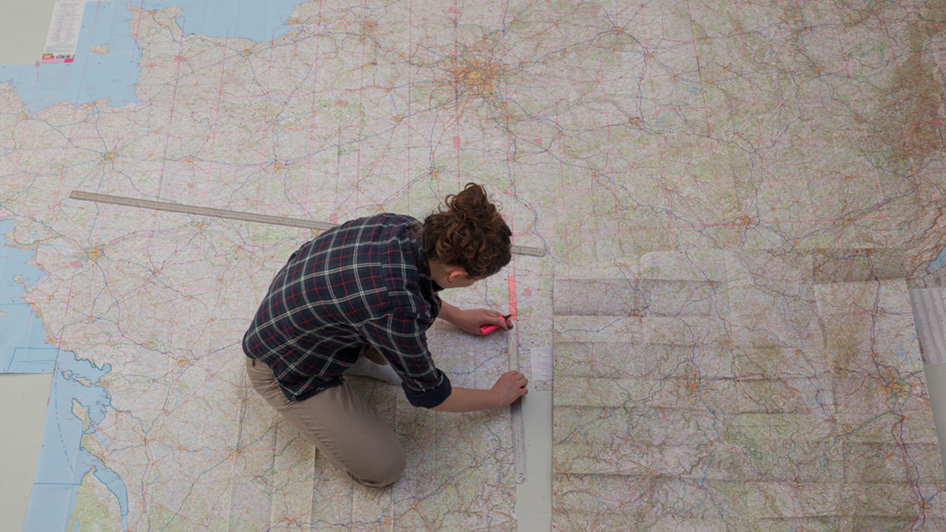
Eric Tabuchi: Most of the photographic works have a tendency to segment the territory, to study one place or a precise context. Thus the representation of related countries is often reduced to its most anecdotal aspects. The most photogenic or spectacular places are being privileged.These works are, of course, interesting but it seems more important to us – and this is where we talk about a methodology – to opt for a more global vision. If we had to summarize, the project of the Atlas is structured by two big principles: on the one side to document the entirety of French territories through the production of an equal number of images for each segment (natural regions) and to photograph every element that makes up those territories, without any hierarchy of value. In this l’ARN draws from cartography,which applies the same rules to a whole studied territory. Another point on which we have to insist on is that the Atlas is an independent initiative, without a sponsor. In this sense, it only corresponds to our own expectations. Some of these considerations are applicable to countries other than France and their possible, related territories. I want to point out that the Atlas is not a reflexive project. If we document France, it is because we live there.

#tcl_block--article-gallery
Donfrontais, La Ferriere aux Etangs
Hurepoix, Corbeil Essonnes
#tcl_block--article-text

I wonder, since photography as a medium of documentation is limited to past and present, which you wholeheartedly capture, how do you consider future living outside of big cities?

Eric Tabuchi: You are right, photography is not a tool for prediction. In this sense, we are not endowed with a particular vision of the future. However, a lot of what we photograph, and that is evident, will disappear. Likewise, many things that are still marginal will become generalized. So we can imagine that the future will be the product of erasing the past and an extension of the present.When it comes to imagining how our lives will be outside of big cities, it’s all just impressions. Actually, I doubt an urban exodus comparable to the rural exodus that marked the history of the French territories will happen. The hypothesis of a rebalancing, as logical and desirable it may seem, still seems distant in my view, with the exception of the outskirts of large cities.

Maybe this impression buffers the hope for a new distribution a bit in which we have the advantages of the city and the countryside at the same time, without experiencing their inconveniences.From what I see, the dominant model remains the one of concentration within big urban centres, with a kind of desertification of the most remote provinces taking place at the same time. I am not a historian but it seems to me that there were, in the 70’s, back-to-the-countryside movements that remained very marginal and that resembled, in a more utopian way, this new ideal of pastoralism 2.0.

#tcl_block--article-gallery
Villiers Charlemagne, Pays de Laval
#tcl_block--article-text

We explore how the rural is an integral part of current urbanization processes and how the dichotomies of urban and rural vanish. Deriving from your travel experience and your French context: Do you have a take on what ruralmeans for you?

Eric Tabuchi: I have to mention that we are neither sociologists nor geographers, that our knowledge of the territory is more empirical and sometimes rather poetic. Nevertheless after many years spent exploring, we are beginning to know this country well and to measure its complexity. So I agree with you when you point out that the cities are no longer defined spaces as opposed to the countryside, that between both extends a growing perimeter where they both merge into each other. In fact, from what I know of Germany, which is also true for Holland or Belgium, the cities blend into the countryside in a more progressive way and this process of merging is effectively notable. In France, it seems to me that hyper-centralization has a liberating effect on large areas where the population density remains very low. Once the French urban cores are left behind, we enter low density territories that have nothing in common with the city, and where isolation can even be a problem.

Also, if we mention the merging of the city and the countryside as a new formation of the construction of the contemporary landscape, I am skeptical when it comes to France. Of course, the phenomenon of dispersion of the big metropolises such as Paris, Marseille, Lille or Lyon is comparable to what is going on in many European countries. Nevertheless, if we sum up the surfaces occupied by big cities and their suburbs they represent less than 5 per cent of the entire country. It is certainly a chance for our country to possess such a source of undeveloped space and it is fascinating to visit the Vercors, les Cévennes or the Creuse and see how these spaces are all singular and how their realities differ from the big cities and their fringes.

Translation: Victoria Guinet


#tcl_block--article-gallery
All photos: Eric Tabuchi
#tcl_block--article-additional-info

Eric Tabuchi, photographer

Eric Tabuchi (https://www.erictabuchi.net/) is a French photographer. He works alongside his partner, artist Nelly Monnier (https://nellymonnier.com/). To keep up with his project you can follow Eric Tabuchi on Instagram (https://www.instagram.com/erictabuchi/) and visit the website of the Atlas (https://atlasrn.fr/). The release of the first map of the Atlas of Natural Regions is scheduled for October, 31stat BAL (Paris).

#tcl_block--article-additional-info

We are interested in your viewpoints:

Comment and discuss this article on our facebook page, or get in touch with the authors or the editors by e-mailing us magazine@urbanes.land.